
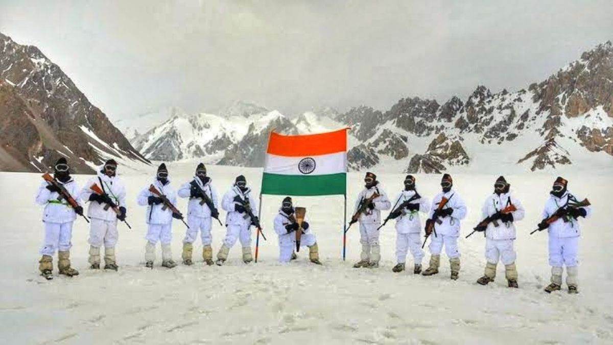
Operation Meghdoot was a military operation undertaken by the Indian Armed Forces to capture the world’s highest battlefield, the Siachen Glacier. This operation countered Pakistan’s desire to capture the glacier to itself and is considered the most critical operation in the Siachen Conflict.
Commencement of Operation Meghdoot: 13th April, 1984.
Duration of Siachen Conflict: 13th April 1984- 25th November 2003 (19 years and 7 months)
Belligerents: India and Pakistan.
Result: Decisive Indian victory (India gains 2500 square kms area)
Causes of the Siachen Conflict:
- Siachen Glacier had been a territory of dispute between India and Pakistan after independence from the British.
- Both the Karachi and Simla aggrements had never mentioned the status of Siachen which led to more uncertainty and both the sides claiming it.
- From then, both countries got into dispute over the control of this strategically important land.
- Both countries allowed expedition teams to survey the glacier from their sides.
- Over time, this issue got really hot and the neighbours decided to occupy Siachen Glacier which started the conflict.
Claims and border statuses:
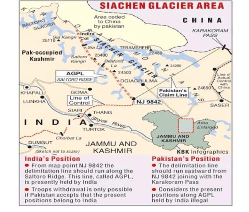
India and Pakistan have a fixed border from near the Gujarat border to the border until Punjab. This line is known as the Redcliffe Line which is accepted by both the sides.. The border after this is not accepted by any side and is heavily militarized. The disputed border in Jammu and Kashmir is called the Line of Control (LoC) which is the U.N designated cease-fire line set under the Simla Agreement in 1972.
If you look at the map, even the LoC ends at a point called NJ9842. This is the start of Siachen Glacier and everything after NJ9842 is ‘ground zero’. Currently, India has the control of Siachen glacier as the Indian Army controls the glacier from NJ9842 and all along the Saltoro Ridge. Whereas, Pakistan claims the glacier from NJ9842 and along a straight line until the Karakoram Pass.
How India got to know about Pakistan’s Plans:
Pakistani Generals first made the plan to occupy Siachen and their operation was code named ‘Ababeel‘ . But later, India got hold of Pakistan’s plans to occupy the glacier when pakistani forces ordered snow gear and equipment for the Pakistani Army. The dealer in London from whom Pakistan ordered snow gear was a regular supplier to the Indian Army.
After this, India immediately sent its troops and equipment to Siachen before Pakistan could even gather its forces.
Casualties and Losses:
Both sides suffered high losses as the conflict lasted for almost two decades.
India suffered 1136 casualties out of which 36 were initial conflict losses and more than 1100 were deaths due to the harsh weather conditions of the glacier. The temperature of the glacier sometimes went past -60 degree celcius.
Pakistan, on the other hand suffered 200 initial conflict losses and more than 700 due to weather conditions.
Confrontation:
- Numerous battles took place between the Indian Army and the Pakistani Army over different periods of time.
- There are several major operations and battles throughout the conflict. The first Indian operation was named Operation Meghdoot and it took place on 13th April by occupying the Bilafond La territory and Sia La territory on 17th of April. This marked the beginning of the Siachen conflict.
- The First battle between two sides took place on 25th April.
- In the coming years, India occupied many key positions. Many clashes took place between the Indian Army and the Pakistani Army.
- Pakistani Forces got weakened over time and finally broke after the end of the 1999 Indo-Pakistani Kargil War. In 2003, four years after the Lahore Summit, cease-fire was organized and India had gained almost 2,553 sq.kms and the whole Siachen Glacier.

Result and the strategic importance of Siachen:
Today, India holds a very tight control over this 2,500 square km region. Indian soldiers have outposts and are sitting at hill tops where as Pakistan’s control is limited to the base of the Saltoro ridge. All the movements of Pakistani troops are monitered by the Indian Army.
The reason behind both countries fighting for this small territory is that this territory is strategically very important. It gives India advantage of preventing a contact between Pakistan and China. This area prevents both China and Pakistan from jointly attack India in the future and a possible invasion of Indian controlled kashmir. If this area comes under Pakistani control, all the movements of the Indian army along Kargil and Leh can be monitered.
If you want to study more about Siachen Conflict or Op Meghdoot, go to:
Siachen Conflict: https://en.wikipedia.org/wiki/Siachen_conflict
Operation Meghdoot: https://en.wikipedia.org/wiki/Operation_Meghdoot
Thank you for reading until here. Adios!